
Campus Development
Electronics, Astronomy, & UAS Campus Support
MSGC is offering an opportunity to our smaller Affiliate Campuses (not including MSU, UM, or Tech) to increase NASA-related capabilities and develop programming in one of three different areas: electronics, astronomy, and unmanned aerial systems (UAS or more commonly know as drones). The intent is for smaller Affiliate Institutions to develop or improve STEM programming on their campuses to either enrich existing curriculum or create new initiatives for students. There will be 4 teams/campuses of 4 members selected to participate in each Campus Development, which provides necessary supplies and training.
MSGC hopes to spread the opportunities among many campuses; each institution should not plan to participate in more than one Campus Development. MSGC will provide travel expenses from the participants home campus to the host campus that include mileage reimbursement, hotel, and meals.
2025 Update: Upon discussing with our Affiliate Representatives, MSGC has made the decision to switch one of the areas from electronics to artificial intelligence (AI).
See Participation Details Below
Upcoming Campus Development Programs

March 2025 Campus Development: Artificial Intelligence
Artificial Intelligence (AI) is rapidly transforming industries, education, and research, making it an essential field of study for students and educators alike. AI encompasses multiple disciplines, including computer science, mathematics, ethics, and data analysis. It enables machines to learn, reason, and solve problems—fundamentals that power technologies such as chatbots, image recognition, predictive analytics, and natural language processing. Understanding AI is crucial for navigating the future of education, work, and innovation.
Information
In partnership with Montana Digital Academy at the University of Montana, and hosted by the University of Providence in Great Falls, MSGC is sponsoring and coordinating the Campus Development on Artificial Intelligence.


This program is designed to provide participants with a foundation in AI concepts and practical applications. The workshop will explore AI fundamentals, large language models (LLMs), ethics in AI, and real-world implementations in education and research. Participants will gain hands-on experience with AI tools such as ChatGPT, Claude, NotebookLM, and Google Gemini. The program will also cover integrating AI into curriculum development, student research projects, and outreach initiatives.
By the end of the program, participants will be equipped to use AI to assist in content development for courses, clubs, public outreach, and research. Attendees will also explore AI tools for data analysis, automation, and enhancing student learning experiences.
Dates
Instructional Dates:
- In-person: March 21-22 at University of Providence in Great Falls, MT
- Virtual: March 28
Travel Dates may extend on either side depending on your location.
Application
The AI Campus Development will be open to all MSGC Affiliated Campuses as individuals versus teams. Submit individual applications for the AI Campus Development in Submittable. Any incomplete applications will not be considered. Applications are due by March 17th, 2025 at 11:59pm MST. We'll notify individual ASAP.
Cost-Share and MSGC Support
Participants should have the ability to access an AI platform for activities on a laptop during, and after, instruction.
Completed
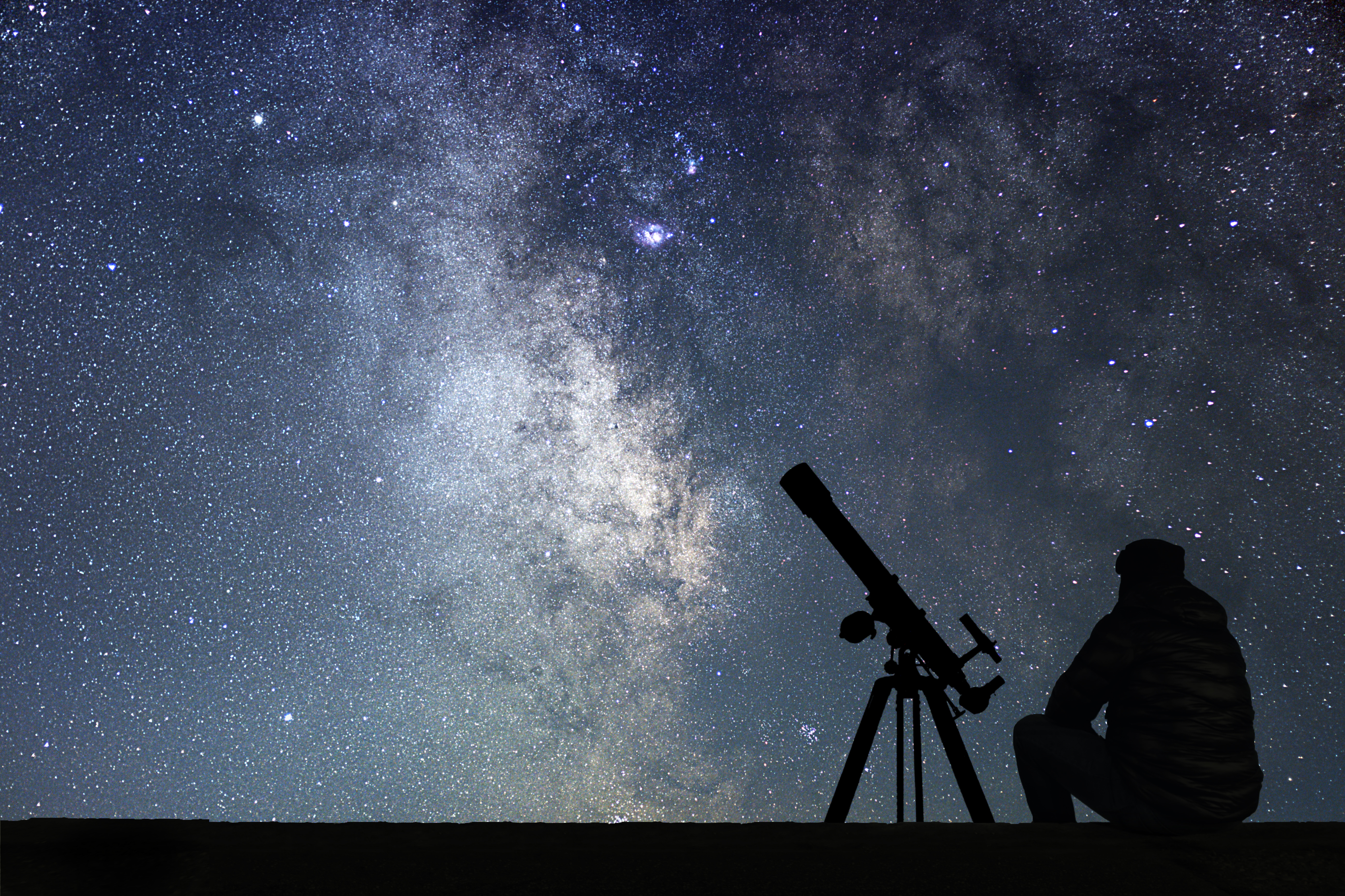
October 2024 Campus Development: Astronomy
Astronomy is one of the oldest natural sciences that studies celestial objects and phenomena that occur in the cosmos. Astronomy encompasses multiple other disciplines such as mathematics: algebra, calculus, statistics, and probability, but also trigonometry and logarithms to calculate things like movement, distances, and even the chemical characteristics of distant stars and galaxies. Physicists and astronomers study the interactions of matter and energy. Astronomy and chemistry overlap and study the abundance and reactions of molecules in the universe and their interaction with radiation.
Information
In partnership with the University of Montana's Astronomy program (Dr. Chani Nava), and Montana State University (Shane Mayer-Gawlik), MSGC is sponsoring and coordinating the Campus Development on Astronomy.
This program is designed to prepare trainees to have the fundamentals to design content that could be used in a course (curriculum), a set of courses, student clubs, outreach to the public, and/or research. Participants can collect and use their own data in addition to archival data for projects. The content will also include types of telescopes, and other aspects including cost, mounts, cameras, accessories, and care.
Dates
Instructional Dates:
- Virtual: October 5-6
- In-person: October 12-13, 2024, location is TBD
Travel Dates may extend on either side depending on your location.
Application
Submit applications for the Astronomy Campus Development in Submittable. Any incomplete applications will not be considered. Applications are due by September 2nd, 2024 at 5pm MST. We'll notify teams by September 6th.
Cost-Share and MSGC Support
MSGC requires that each campus must have a designated area established for a telescope and install a telescope mount there. (Please contact us for more information.) MSGC will provide an advanced telescope and eyepieces.
Please contact us for questions or more details at msgc@montana.edu.
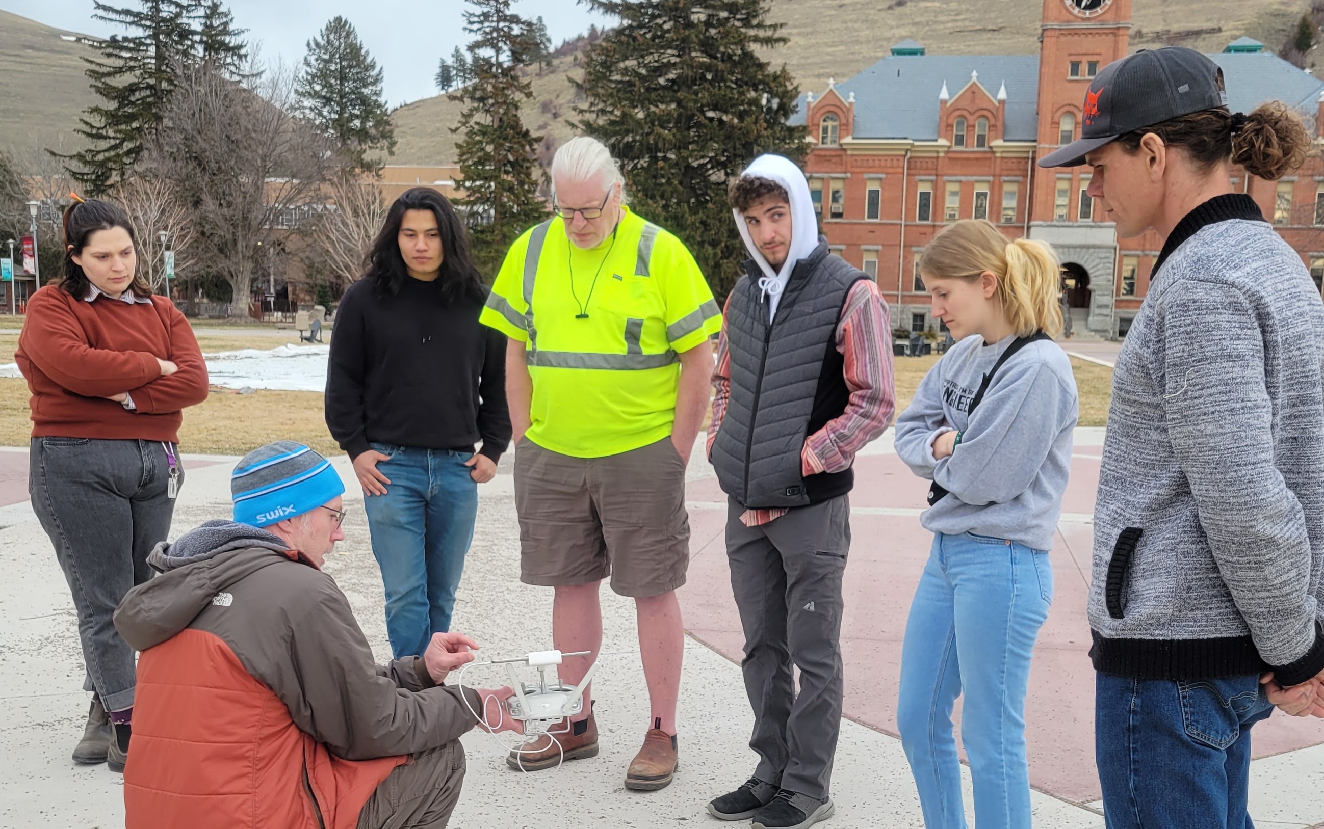
April 2024 Pilot Campus Development: UAS
Unmanned Aerial Systems, or more commonly referred to as drones, is a rising technology that been around for quite sometime. They have a vast array of applications such as emergency response, wildlife conservation, agriculture, weather forecasting, water treatment, geological surveying, land management, aircraft maintenance, education, and space missions.
Information
 In partnership with the University of Montana's Autonomous Aerial Systems Office (AASO), this program is designed to prepare trainees to pass the FAA’s Small Unmanned Aircraft
System (UAS) Rule (Part 107) test to obtain a Remote Pilot Certificate as well as
to train participants to do basic UAS-GIS analysis.
In partnership with the University of Montana's Autonomous Aerial Systems Office (AASO), this program is designed to prepare trainees to pass the FAA’s Small Unmanned Aircraft
System (UAS) Rule (Part 107) test to obtain a Remote Pilot Certificate as well as
to train participants to do basic UAS-GIS analysis.
The program will cover the following topics:
- Regulations relating to UAS rating privileges, limitations, and flight operations
- Airspace classification and flight restrictions affecting UAS operations
- Aviation weather sources and effects of weather on UAS performance
- UAS loading and performance
- Emergency procedures, Crew resource management, Radio communication procedures
- Physiological effects of drugs and alcohol
- Airport operations and aeronautical decision-making and judgment
- Maintenance and preflight inspection procedures
- Operation at night and over people
- Basic photogrametry, mapping images into GIS tools.
Dates
Instructional Dates: April 13-14 and April 20-21, 2024.
Application
Submit applications for our first pilot Campus Development in Submittable. Any incomplete applications will not be considered. Applications are due by February 14th, 2024 at 5pm MST. We'll notify teams by February 19th.
UAS equipment and software
Please see the recommended equipment below.
| UAS w/Built in Cameras | Description | Category | Flight Time | Cost | Country of manufacture |
| DJI Mavic 3 Pro |
48 megapixel (MP) red, green, blue (RGB) camera, capable of obstacle avoidance and automated flight, 5.1k resolution video at 50 frames per second (fps).
|
Best available for lowest price | 30 minutes | $3,000 | China |
| Autel Evo II Pro 6K Rugged Bundle V3 |
20 megapixel RGB 6k resolution video. Obstacle avoidance, automated flight. RGB + thermal available for about $9000
|
Lowest price | 25 minutes | $2,000 | China |
| Skydio 2+ Enterprise | 12 MP camera, 4k 60fps video. UAS Capable of indoor and outdoor photogrammetry. Very good obstacle avoidance and target tracking. Very good at autonomous 3D modeling of things like bridges and towers. | Best available US-made for lowest price, indoor/outdoor survey | 20 minutes | $3,000 | US |
| Software | Description | Category | Cost | Country of manufacture |
| ArcGIS Pro |
Many campuses already have access to ArcGIS Pro. Within ArcGIS Pro, there are tools available like the orthomosaic wizard that can do 3D photogrammetry processing.
|
US Software, most likely already accessible on your campus | Multiple seats available in MUS system | US |
| Pix4D Mapper |
MSGC will be purchasing this academic software (25 seats) to be shared between multiple campuses. But if you want to buy it for your campus the pricing is $3000 for 25 permanent seats (with about $1000/yr maintenance fee for upgrades and customer service).
|
User friendly, good compatibility with free autonomous flight planning software Pix4D Capture | MSGC shared software, can purchase separately, $3000 for 25 permanent academic licenses | Switzerland |
| Optional | ||||
| Agisoft Metashape |
If you want just a few licenses Metashape is probably the cheapest educational (and commercial) option. It is $550 for each permanent seat. There are some capabilities that may be even better than Pix4D such as civil engineering applications and the ability to create 3D models from just 2 photos. PC based option only.
|
Least expensive on a per seat basis | $550/seat | Russia |
| Drone Deploy |
This is one of the more expensive licenses on the market, but still popular. It is a strictly cloud based software available with a monthly/yearly subscription.
|
Relatively expensive cloud based software | $4000/seat/yr | US |
| OpenDroneMap |
Free open-source software. May take a bit of programming and more development to get up and running.
|
Free software | Free | US |
You can create 3D models without ground control that might be accurate within about 25cm (10in), which may be totally acceptable in some applications. Often though there are large distortions especially at the edges of surveys or on different sides of a river, etc. You can prevent these distortions and obtain cm-level accuracy 3D models using relatively inexpensive UAS and GNSS systems with ground control.
Check to see if your school have GNSS equipment available to borrow and what type/model of GNSS system and antenna it is. The older GNSS equipment is only accurate to 1-3 meters and there are some pitfalls to avoid purchasing (relatively inexpensive) equipment that may not be very accurate in many remote parts of MT. You can get away with just purchasing one GNSS system but to be most effective with you time you might consider purchasing 2 systems, 1 to use as base station and 1 to use as a rover.
| GNSS | Description | Category | Flight Time | Cost | Country of manufacture |
| Emlid Reach RS2+ GNSS Receiver | This receiver is capable of cm-level accuracy as long as you are within 100km of a base station. The accuracy declines by a "rule of thumb" 1cm per 10km from a base station. Make sure that you do not purchase less expensive models ( ie. RS or RX) because they may only be accurate within 10km from a base station. Same goes for many other systems on the market (ie Bad Elf, Arrow, etc.). Unit is about $2500 but you want to include accessories like a tripod, 2m range pole, tablet or phone holder, so total is about $3000 per unit. | Best available for lowest price | 8 hours on one battery is probable | $3000/unit | China |
Please contact us for questions or more details at msgc@montana.edu.
Participation Details
Teams
Each small Affiliate Institution can apply for any one of the three areas and select 4 individuals to attend one campus development. Each team must include at least 2 faculty or staff members. The team can include a maximum of two students. You can give one alternative person to replace a listed team member in case of emergencies.
There will be 4 teams/campuses of 4 members selected to participate in each Campus Development. There needs to be a minimum of 2 people per team.
Scheduling/Timing
Each opportunity will take place over two weekends, a Saturday and a Sunday, for a total of four days.
Cost-Share
This opportunity requires cost-share per NASA regulations by each participating campus. Cost share must be non-federal; purchases can be from another grant only if it has a non-federal source.
- Electronic cost-share: Each campus must purchase an Altium printed circuit board (PCB) software license and have a dedicated area for students to use the supplies.
- Astronomy cost-share: Each campus must have a designated area established for a telescope and install a telescope mount there.
- UAS cost-share: Each campus must purchase or supply a drone. The cost-share value must be at least $1,250.
- AI cost-share: TBA
MSGC Will Provide
- Travel expenses from the home campus to the host campus that include mileage reimbursement, hotel, and meals. Ride-sharing will be required.
- Qualified Instructor: MSGC will pay for an experienced instructor, who will travel to the host campus/location for training.
- Necessary equipment and supplies that are not covered in the cost-share.
- Electronics: Microscope, oscilloscope, soldering station, stock items, and a 3D printer.
- Astronomy: Advanced telescope and eyepieces.
- UAS: Sensors, two 107 Pilot license fees at $175 each, and shared licenses for the Pix4D image processing software.
- AI: TBA
Location
Each opportunity will take place on a host campus selected from the awarded applicants. We will do our best to take into account traveling distances.
Requirements
Application: one person from an Affiliate Campus must submit an application via Submittable that includes:
- An indication that if they are the MSGC Affiliate Representative, they have discussed this opportunity with the STEM faculty on their campus. If they are not the Affiliate Representative, they must indicate that they discussed their application with the STEM faculty and MSGC Affiliate Representative for their campus and they (the Rep) are aware they are submitting an application.
- A description of how this Campus Development opportunity will help the proposed team enhance STEM education on their campus.
- A description of what project(s) the campus would initiate, including a timeline and detailed roles for the team members. If other community or government partners will be included, a description illustrating the interface between the campus and partner(s).
- An analysis of campus strengths, weaknesses, what opportunities attending this Campus Development would afford, and what challenges might have to be planned for or around.
- A sustainability Plan, indicating an outline of how the campus is planning on supporting the initiative detailed above.
- An indication of the cost-share responsibility of the institution.
- A letter of support from a senior person on campus (President, Provost, Dean, etc) that signifies the administration is supportive of the above project and sustainability plan.